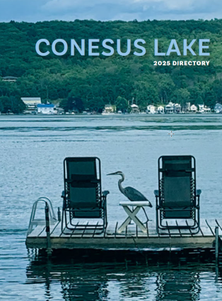
SAILBOAT EAST LAKE CLA CROPPED IMG_2844

Welcome to Conesus Lake Association

The Conesus Lake Association is a not-for-profit organization that has worked since 1932 to promote the health, safety and welfare of the residents, both permanent and seasonal, of Conesus Lake in Livingston County, NY. With over 1,000 members, the CLA continues to provide a common voice for the concerns, needs and challenges that face our watershed and lake.

September HABS presentation

If you live on the Lake and want to learn about Harmful Algal Blooms, here's your chance. Attend this free seminar at the Watershed Education Center in Vital Park on September 18th. This is in person only. Click on the link below to register. Click Here to Register  
Read More

Lake News & Articles

September HABS presentation

If you live on the Lake and want to learn about Harmful Algal Blooms, here’s your chance. Attend this free seminar at the Watershed Education Center in Vital Park on September 18th. This is in person only. Click on the link below to register. Click Here to Register


...
Read More

See Something – Say Something...

We need your help! HAB Volunteer Monitor Program

...
Read More

Dock numbering

Did you know that the CLA provides free house numbers for the end of your dock?
As part of our Lake Safety program we make and deliver house numbers for your dock so Emergency Responders arriving via boat can find your house as quickly as possible.
To request your dock numbers, click on the link below and complete the form.


Dock House Number request form
...
Read More

Lake Level Monitoring

The following article was published in the Fall-Winter 2008 issue of Laker News.

The challenge of managing our lake’s water level

The rapid drawdown of Conesus Lake this fall and the resulting shallow water caused many lake residents to express concern about their ability to remove their boats at the end of the season. The early closure of the state boat launch on East Lake Road and the trend in recent years to keep boats in the lake later in the season contributed to the concern.
The Livingston County Water and Sewer Authority (LCWSA) is operationally in control of maintaining the lake’s water level by making adjustments at the flood control dam at the north end of the lake. Officers of the CLA met with LCWSA staffers recently to discuss the situation. The outcome was confirmation that the Authority would continue to manage the level of Conesus Lake as close to the designated summer level as possible until at least November 1, 2008.
The CLA values the ongoing cooperation from everyone at LCWSA as they work to maintain the target lake levels throughout the year.
The following historical overview of lake-level management on Conesus Lake may help you better understand the challenges of maintaining desired lake levels.
Managing the lake level involves attempting to satisfy several objectives.
Sometimes these objectives can be in conflict with each other:
  •  Maintain a minimum discharge from the lake (6.5 million gallons per day) as mandated by the New York State Department of Environmental Conservation(NYSDEC) for operation of the LCWSA waste treatment plant
  • Minimize lakeshore flooding caused by major rain and windstorms, while maintaining a sufficiently high lake level for summer/fall recreation
  • Reduce potential for spring ice damage, while maintaining a sufficiently high lake level for fish spawning
  • Lower the lake level rapidly following a widespread major rain event, while minimizing downstream flooding.
Lake levels during the year are managed within specifications that have been developed by the U.S. Army Corps of Engineers (ACE).
Lake Level (in feet above sea level)
Maximum 819.5’
March through June                   818.7
July through October                 818.5
November through February   816.5
Minimum                                        815.5
Prior to the construction of the present flood control dam at the lake’s north end, spring flooding was a frequent occurrence. Docks, retaining walls, lawns, and homes routinely suffered damage. In fact, floods or near-floods were reported 98 times between 1930 and 1972. Floods of significant magnitude occurred in March 1936, May 1954, March 1956, April1960, and June l972.The worst flood on record was the tail end of tropical storm Agnes in June 1972.The flood stage on Conesus Lake reached 822.6 ft. causing extensive property damage along the shoreline. ln July 1978 the ACE reported: “the primary cause of the flood damage was the inadequacy of the Conesus Creek outlet to discharge the high quantities of water in Conesus Lake produced by excessive rainfall and/or snowmelt conditions.” The first reported action to control the lake level occurred 160 years ago when the state authorized construction that would enable Conesus Lake to supply water to the Erie Canal via the Genesee River.
In 1920, a weir was constructed in the outlet about one-and-a-half miles north of the lake near Route 256 during an investigation of the use of Conesus Lake as a possible water supply for the City of Rochester. Twenty-four years later, the CLA and the village of Avon requested that the ACE take steps to regulate the level using a dam to be constructed across the outlet. For many years informal lake-level control methods were used by lake residents. Initially sand bags were placed in the outlet. In 1952, a crude pile and plank dam was installed. On occasion, these actions were opposed by downstream land owners who wanted more water flow during dry periods. Conflicts sometimes arose when the restrictions to flow were removed over the objections of lake residents.
The ACE, in 1950, recommended that the outlet channel from the lake to Route 256 be cleaned out and that a control structure be constructed 1000 ft. from the lake. Just over a dozen years later, the NYSDEC recommended that Conesus Lake be equipped with an artificial lake level control. At the January 1964 meeting of the CLA’s Board of Directors, lake level control was chosen as the organization’s primary goal. Later that year the CLA constructed a sheet-metal-pile weir with movable boards in the original Conesus Creek outlet near Route 20A. Boards were inserted to restrict discharge in an attempt to maintain desirable summer recreation lake levels. NOTE: the DEC permit for this dam is dated August 4, 1967. As we have found numerous references in the files to the dam’s construction in 1964, we’ve stuck with that year for this article. Perhaps the 1967 permit was retroactive or it was for a 1967 modification to the original permit. From 1964 to 1976, the CLA operated the weir, maintaining a summer lake level of 819.0 ft. above sea level. Though the weir worked reasonably well during periods of normal rainfall patterns, it was ineffective during major storm events because the original outlet did not allow the rapid discharge of water from the lake. The 819.0 ft. lake level was acceptable to residents in shallow water areas, but created problems for residents with low properties. The 819.0 level is only 12 inches from flood stage for the lowest properties in our area. Steep slopes in the watershed can create significant runoff during major storms and often caused the lake to rise one foot in less than 24 hours. The 819.0 level caused many lawns to be spongy and damp most of the year, created breeding grounds for mosquitoes, prevented recreational use of lakeside lawns, damaged house foundations and, during high wind conditions, caused shoreline erosion. In 1972, as the floodwaters of tropical storm Agnes receded, the CLA became an aggressive advocate for the development of an improved flood control system. A major effort was undertaken to enlist the support of state and federal elected officials, resulting in a detailed study by the ACE. The initial draft of the study was presented in July 1981. Numerous agencies and organizations participated in the study. The ACE had the principle responsibility. The NYSDEC was the lead non-federal agency. Other participants included the Livingston County Planning Board; the towns of Geneseo, Groveland, Livonia, and Conesus; and numerous public officials. The Conesus Lake Association provided extensive assistance to the study by compiling records of flood damage, photos, and other pertinent information. Using residents’ documentation, the CLA was able to show the ACE that flood damage between 1972 and 1980 was in the range of $1 million, a sizable sum for that time. On June 7, 1980, the CLA wrote a letter to the ACE in response to their request for a recommendation on the summer water level. The CLA conducted a study and found that the median lake level between wet and dry periods during a year historically had been generally reported to be 818.0 ft. Therefore, they concluded, it would be logical to establish 818.0 ft. as a desirable summer level. During the summer of 1979 the CLA attempted to manage the lake level at 818.0 ft. and received numerous complaints from residents at the north end and those living on the south side of various points. They said the water was too low and prohibited the use of motorboats and swimming facilities. In 1980, using the original weir, the CLA attempted to maintain a level of 818.5 ft. and received the least number of complaints. One problem was noted: without a reliable source of water throughout the summer, it wouldn’t always be possible to maintain the desired 818.5 ft. level. The CLA concluded that the desired range should be between 818.0 to 818.5 ft. Our organization noted that shallow problem areas were likely to worsen in the future as sediment built up in the north end and south sides of the lake’s points.
In July 1981, the ACE completed the Stage III Project Report and Environmental Impact Statement. They found a need for construction of a flood-damage reduction project on the Conesus Lake outlet. The project was designed to protect against a flood that could be expected to occur once in every 25 years.
The original wet was removed in 1987 and construction of the new flood control dam was started. At that time the CLA relinquished its responsibility for managing lake levels. The Conesus Lake Flood Control Project was completed in 1988. At the end of November 1983 the towns of Conesus, Geneseo, Groveland, and Livonia entered into an agreement that established the Conesus Lake Compact. This enabled the four towns surrounding the lake to “cooperatively undertake
certain responsibilities and duties with respect to a flood protection project in Conesus Creek at the outlet of Conesus Lake.” The Compact would assume responsibility for operation and routine maintenance of the Flood Control Project including the lake level control dam and the new outlet configuration constructed by the ACE and New York State. Voting rights and costs were to be distributed among these four towns based on lake frontage within each town.
On March 1, 2003, the Compact of Towns contracted with the Livingston County Water and Sewer Authority (LCWSA) for the daily operation and routine maintenance of the flood control dam. According to Cathy Muscarella*, the LCWSA’s Executive Director, “the Conesus Lake Compact still is the ultimate authority on lake levels. We simply provide the manpower and daily diligence to see that the levels are kept as close as possible to what has been decided is appropriate for a given date.” The LCWSA’s current contract with the Compact of Towns runs to March 1, 2010**.According to the current contract, in effect since March 2005, the chief duties of LCWSA are as follows: measuring and recording lake level and stream flow daily; adjusting gates to meet seasonal lake level requirements; making minor repairs on the central gate structure; removing small debris from the channel; removing shoals, large trees and other large debris from the channel; and performing annual brush control on the channel’s banks.
Contributors to this article were:
Gene Bolster
John Connelly
George Coolbaugh
*Her present married name is Cathy Van Horne.
**There is a new contract in effect. It was signed on March 14, 2013.
...
Read More

Marine Patrol and 2024 Safe Boating...

The Marine Patrol is responsible for insuring the safety of residents and visitors on Conesus Lake by enforcing New York State Penal and Navigation Law. A sergeant and four deputies staff the Marine Patrol May through September.

Safe Boating Laws and Course(s)

Beginning January 1, 2025, ALL boaters and Personal Watercraft (PWC) operators in New York will be required to have completed a New York State Safe Boating Course.
Learn more about timelines and emerging legislation

The Sheriff’s Office will be offering in-person courses, registration is available online only:

Saturday, May 4,  2024 – register here.

Students must be at least 10 years old to attend. A parent or guardian must sign their child in, but need not remain for the class if they so choose. Please bring a photo ID to aid in registration.

The class is eight hours long. Please plan accordingly for lunch and a snack.  If you register and then find that you cannot attend, please cancel your registration so that another student may sign-up.

There is no cost to attend, but New York State collects a $10 fee to receive your card.

Learn more about how to take a New York State approved course online


...
Read More

Events

No Upcoming Events found

Email Signup

Sign up for the CLA’s News and/or Alert system. Get timely information that affects your quality of life at the Lake.

Questions? Concerns?

Find your question or concern and click to get the quickest response

Local Weather Data

Find local weather information and conditions

Conesus Lake Weather Data

Comprehensive weather data is available from two weather stations on the Conesus Lake shoreline. The locations are Vitale Park on the north end, and DEC Wildlife Area about 8 miles south. The weather parameters are wind (average speed, peak gust speed, direction), rainfall, air temperature, atmospheric pressure, solar radiation, photosynthetically active radiation, relative humidity, and dew point.
The weather data can be observed using the following steps:
To view current conditions at Conesus NORTH -> CLICK HERE
To view current conditions at Conesus SOUTH -> CLICK HERE
To view past conditions, click on GRAPHS and then the tab for Past Day, Past Week, or Past Month.
To export data files, click on EXPORTS.
LINK TO ADDITIONAL HISTORIC LAKE DATA

CLA YouTube Videos

HABs SUNY Geneseo Presentation

June 1st

Welcome to another presentation at the Watershed Education Center, presented by the Conesus Lake Association.
Please watch as Dr. Sid Bosch, a Professor at SUNY Genseso presents work being done and data associated with Harmful Algal Blooms on Conesus Lake.
...

2024 Livonia High School Students

June 1st

Welcome to another presentation at the Conesus Lake Association's Watershed Education Center. Tonight's presentation is by the students of Livonia High School Science teacher, Mr. Brian Sheldon. ...

How to install your Rain Barrel Video Final

April 29th

How to install your new rain barrel once you get it home. ...

Preparing for Totality - The Solar Eclipse of 2024.

March 10th

The Conesus Lake Association Presents another great eduational video at their Watershed Education Center. Tonight Dan Schneiderman, the Rochester and Museum Science Center's Eclipse Partnership Coordinator, presents a talk on the April 8, 2024 Solar Eclipse.

Some key Timestamps:
0:00 Conesus Intro
1:53 Solar Eclipse Basics
6:45 Silent Video
7:45 What you will observe in the sky
10:02 Important Timeline of Eclipse Path
23:05 Travel Path of eclipse
39:19 SAFETY

Also please visit the Rochester and Museum Science Center's Website for more info: https://rmsc.org/

Also visit the Chip Holt Nature Center for a presenation on the Solar Eclipse on Friday, March 22nd from 7-8:30 and learn how to make a cereal box solar eclipse viewer. https://chipholtnaturecenter.org/summer-program.html


*******************************************************************
PDF of the presentation can be found below:
https://drive.google.com/file/d/1LNdL6JdsSHhU-EeIa1DI9_55L0RcKl-W/view?usp=sharing
...


Find us on Google Map

Lake Level Monitoring