CONESUS LAKE – The Facts
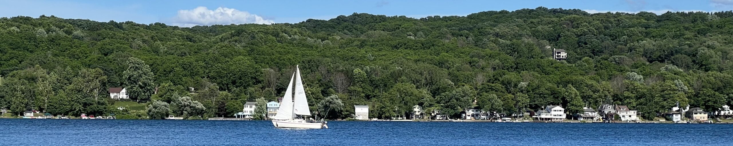
 Long considered the “jewel” of New York State’s Livingston County, Conesus Lake is located approximately 25 miles south of Rochester and parallels Interstate 390 as it runs from Lake Ontario south toward the Pennsylvania border.
Conesus Lake is the most westward of New York’s Finger Lakes chain. These 11 “major and minor” lakes were formed over 10,000 years ago when the last glaciers receded and northward-flowing rivers became blocked with massive glacial debris. Heading from east to west, these lakes are Otisco, Skaneateles, Owasco, Cayuga, Seneca, Keuka, Canandaigua, Honeoye, Canadice, Hemlock, and Conesus. They resemble slim fingers fanning out in a north/south orientation across Central and Western New York.
The shoreline of Conesus Lake includes portions of the towns of Conesus, Geneseo, Groveland, and Livonia. Despite its modest size, Conesus is one of the most heavily populated Finger Lakes, largely due to the fact that the entire lake is served by public sewers and water, electricity, natural gas, and cable television access, and is within a short drive of New York’s third-largest city (Rochester). Although seasonal cottages still make up a noteworthy percentage of the lake’s dwellings, approximately 65% of the lake’s residents now live here throughout the year.
 Conesus Lake also serves as the public water supply for the villages of Avon and Geneseo, providing drinking water to approximately 15,000 people (22% of the total population of Livingston County).
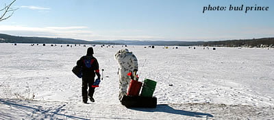
For residents and visitors alike, Conesus Lake is renowned as a year-round sporting and water-based recreation destination. Fishing, power boating, sailing, canoeing/kayaking, swimming, and cycling (around the lake) are enjoyed in the warmer months; waterfowl hunting in the autumn; and ice fishing, ice skating, and snowmobiling when the lake is frozen. It is only in the rarest of winters when the lake fails to freeze from one end to the other.
Conesus Lake, New York – The Figures
| Latitude/Longitude: | 42°47’N; 77°43’W |
| Elevation: | 818 feet (249 m) above sea level |
| Length: | 8 miles (12.9 km) |
| Maximum Width: | 1 mile (1.6 km) |
| Maximum Depth: | 66 feet (20m) – 90%+ less than 45 feet (13.7m) deep |
| Area: | 5.3 square miles (13.7 km2) |
| Shoreline: | 18.4 miles (29.6 km) |
* The “minor” Finger Lakes, as defined by the U.S. Geological Survey, are shown in italics.